The project site is located on 23 acres in Jackson Hole and
situated adjacent to a levee along the Snake River. The Jackson
Hole landscape is a result of catastrophic block fault uplifting,
which created the dramatic Teton Mountain Range, and steady
grinding from glaciating, which created valleys and canyons,
and the Snake River. Historically, the Snake River flowed
unrestrained over the valley floor, but in the 1950s the US
Army Corps of Engineers began building the first embankments
to contain overflows of the river. Today we know that the
lush riparian landscape on either side of the levee, which
depends on periodic flooding of the river to restore itself
and regenerate cottonwood growth, is in jeopardy due to these
levees.
Although the project site was impacted by the levees, it
was still rich in wildlife values and wetlands. However, further
examination revealed that the wetlands were disappearing and
the cottonwood forest was maturing without potential for regeneration.
The property had been subdivided into
two lots by the previous owner and in the course of attaining
entitlements, 70% of the property had been placed in a conservation easement designed
to protect the site’s natural resource values. Two
building envelopes were created, each approximately 0.8
acres.
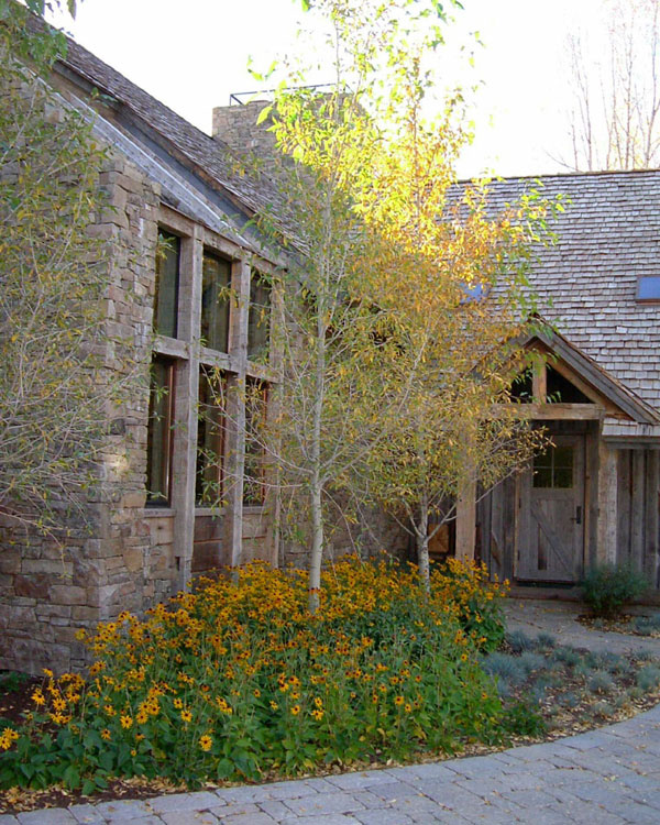
The client chose the building site closest to the levee,
located in a stand of mature cottonwoods, and surrounded by
wetlands. The site was essentially flat except for broad shallow
depressions, which crossed the property from north to south.
These depressions, or swales, were remnant channels of the
Snake River, created during the periodic flood events that
occurred prior to the construction of the levees. The bottoms
of the swales were considered wetlands, but there were indications
that these wetlands were disappearing without the sedimentation
that occurred with the flood events. They appeared scoured,
consisting only of exposed cobble and wetland vegetation.
The solution lay in a site development approach that emphasized
the natural resources present on the site and a plan that
would enhance the existing wetlands, while restoring the regenerative
process for the cottonwood forest. Meeting these criteria
would require an extensive amount of disturbance in the remnant
river channels outside of the building envelope. The channels
would need to be excavated, lined to control water elevations,
and backfilled with suitable soil in order to sustain a healthy
wetland plant regime. We were able to build consensus between
the wetland consultant, the US Army Corps of Engineers, and
the Teton County Scenic Preserve Trust that we could improve
the wetland and resource values on the site through the development
of the plan.
The client asked the landscape architects to review the recorded
road layout and building site to assess its constraints and
opportunities. He has a strong appreciation and respect for
the natural landscape and wanted to develop the property in
an ecologically sound manner.
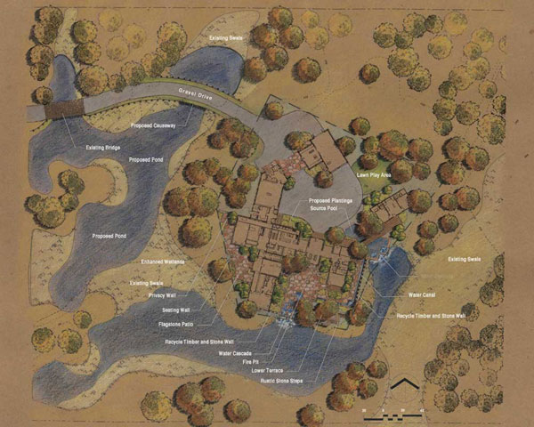
The landscape architects' first recommendation was to realign
the roadway in order to protect the existing cottonwoods and
to build retaining walls along the sides of the roadway where
it crossed the wetlands. The retaining walls would serve to
lessen slopes on either side of the road which would also
minimize impacts to the wetlands. This also created a causeway
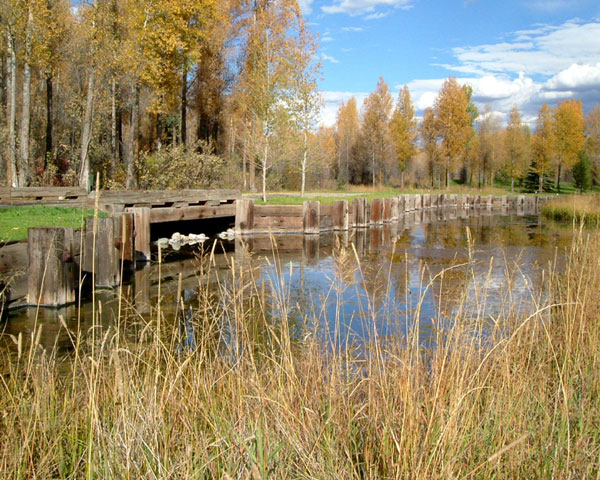
effect that would enhance the arrival to the home site. Roadway
bridges were designed to have a low profile and were faced
with timbers that were reclaimed from a railroad trestle that
crosses the Great Salt Lake in Utah. The retaining walls were
constructed from the same materials.
The building site was very tight for
the client’s building program, which included a main house, guesthouse, and a barn.
All of these structures as well as circulation and landscaping,
would have to occur within the 0.8 acre building envelope.
The challenge was to develop a site plan and site development
program which would satisfy the client’s program and
respect the constraints of the site.
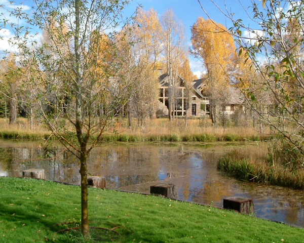
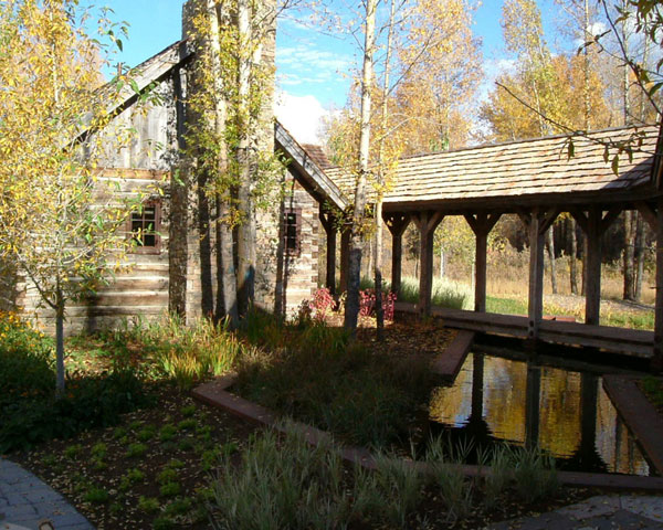
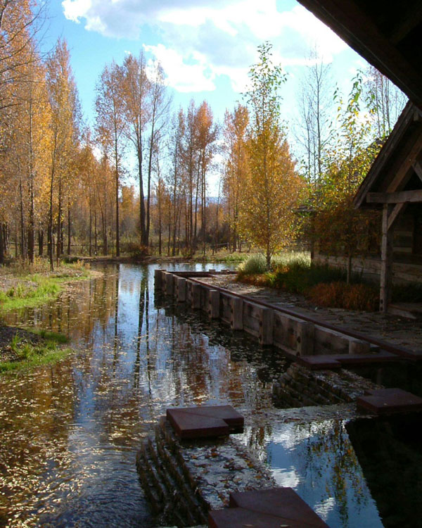
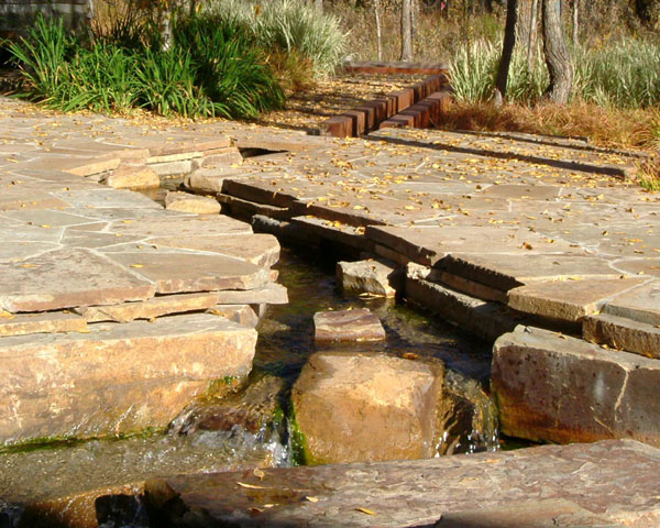
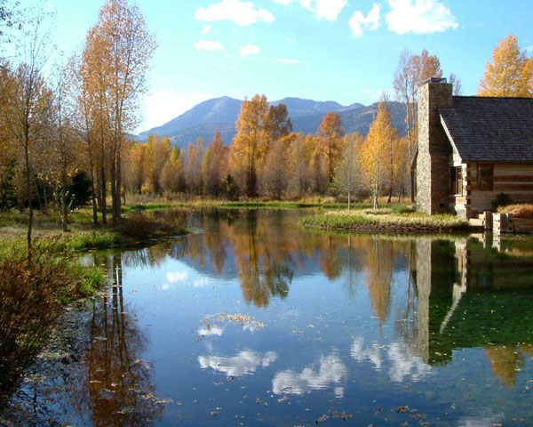
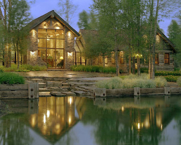
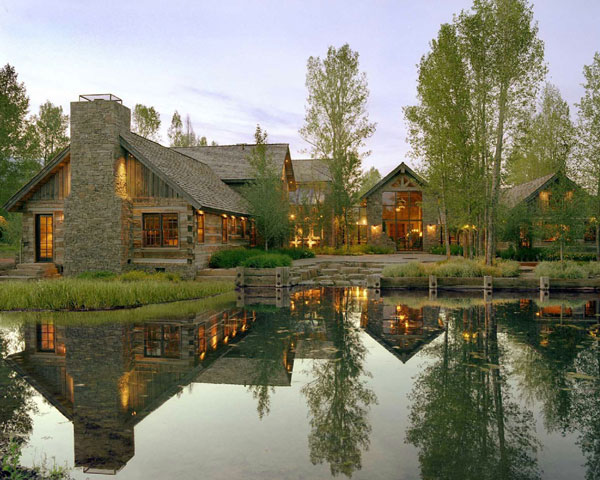
VLA Inc.'s concept for the house site
was to create an island in the forest, surrounded by water
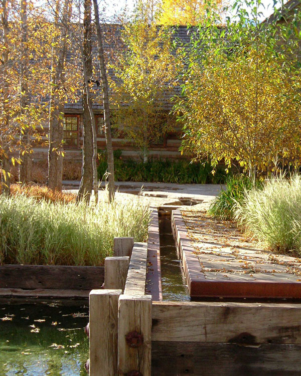
and wetland reclamation plantings. The swales surrounding the house site were lined
in order to maintain a consistent water elevation and water
was introduced by means of a well and source pool located
between the main house and the guesthouse. Water from the
source pool flows under a covered walkway connecting the
guesthouse to the main house and cascades over a stone wall to the head
of the pond system. Additional water is drawn off of the
source pool by a steel water canal, reminiscent of the old logging
operation, which took place on the property in the 1950’s.
The water canal follows a wall, faced with the same reclaimed
timbers used on the causeway, which defines the edge of
the building envelope and forms the back terrace. The landscaping
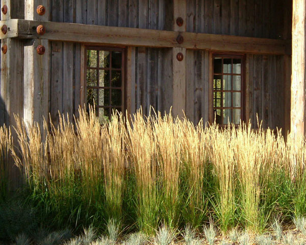
is composed of indigenous shrubs, perennials, and grasses.
VLA's role was to create a seamless integration of elements mirroring the client’s desire to have
a house embodying a mountain lifestyle, while exemplifying a respect for the natural resources present on the property. They were responsible
for preparing the site development concept and obtaining the necessary entitlements. VLA worked closely with the wetland
consultant, who advised on existing wetland conditions for the project, and was also the builder. The landscape architects
were additionally responsible for all the exterior hardscape and landscape design, including water features, walls, and
terraces.
This project was unique in that the opportunity existed to create a dramatic setting for the house site, complimentary
of and beneficial to, the existing landscape requiring support from the federal agencies responsible for protection of wetlands
and the local agency responsible for overseeing the natural resources present on the site. By understanding the concerns
of all parties involved, the landscape architects were able to craft a solution which appealed to everyone concerned and
has become an exemplary design model for similar sites in the valley.
|