
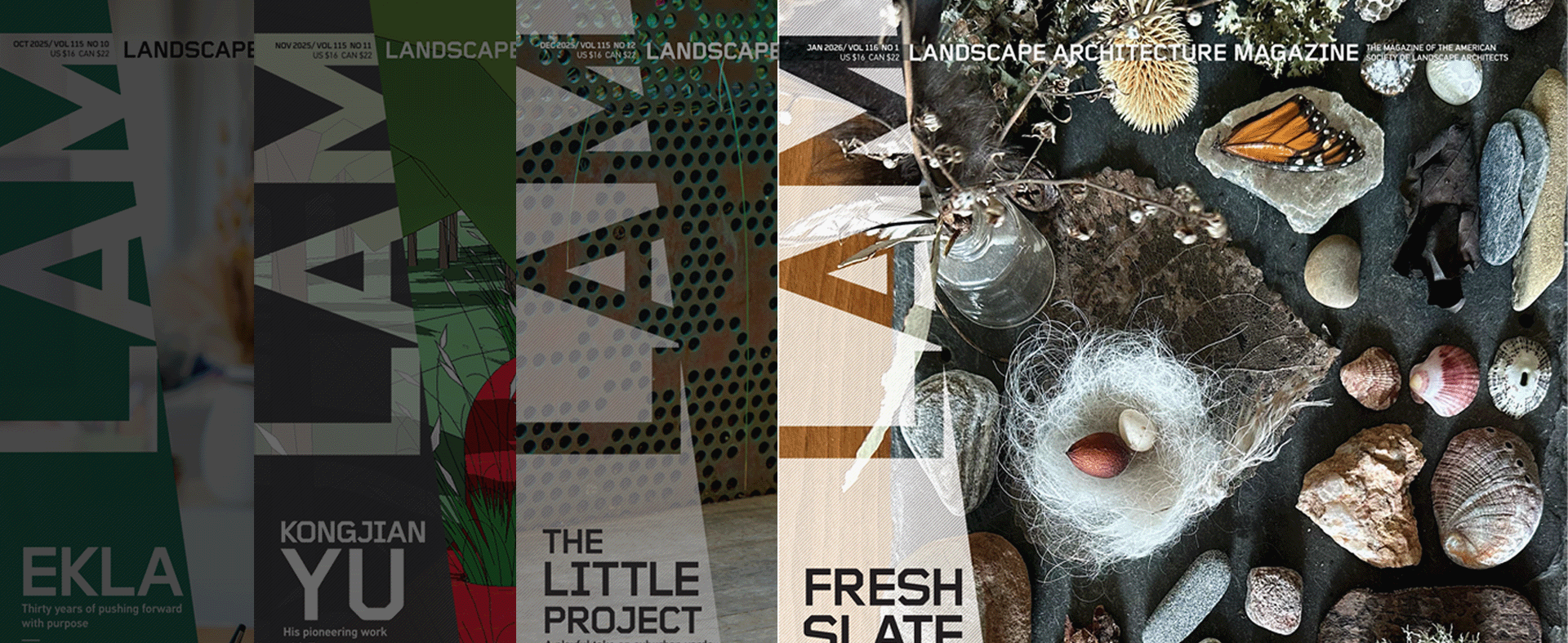
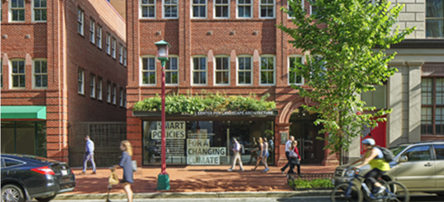
.webp?language=en-US)
Advertisement
2016 ASLA Professional Awards
Explore:
General Design Category
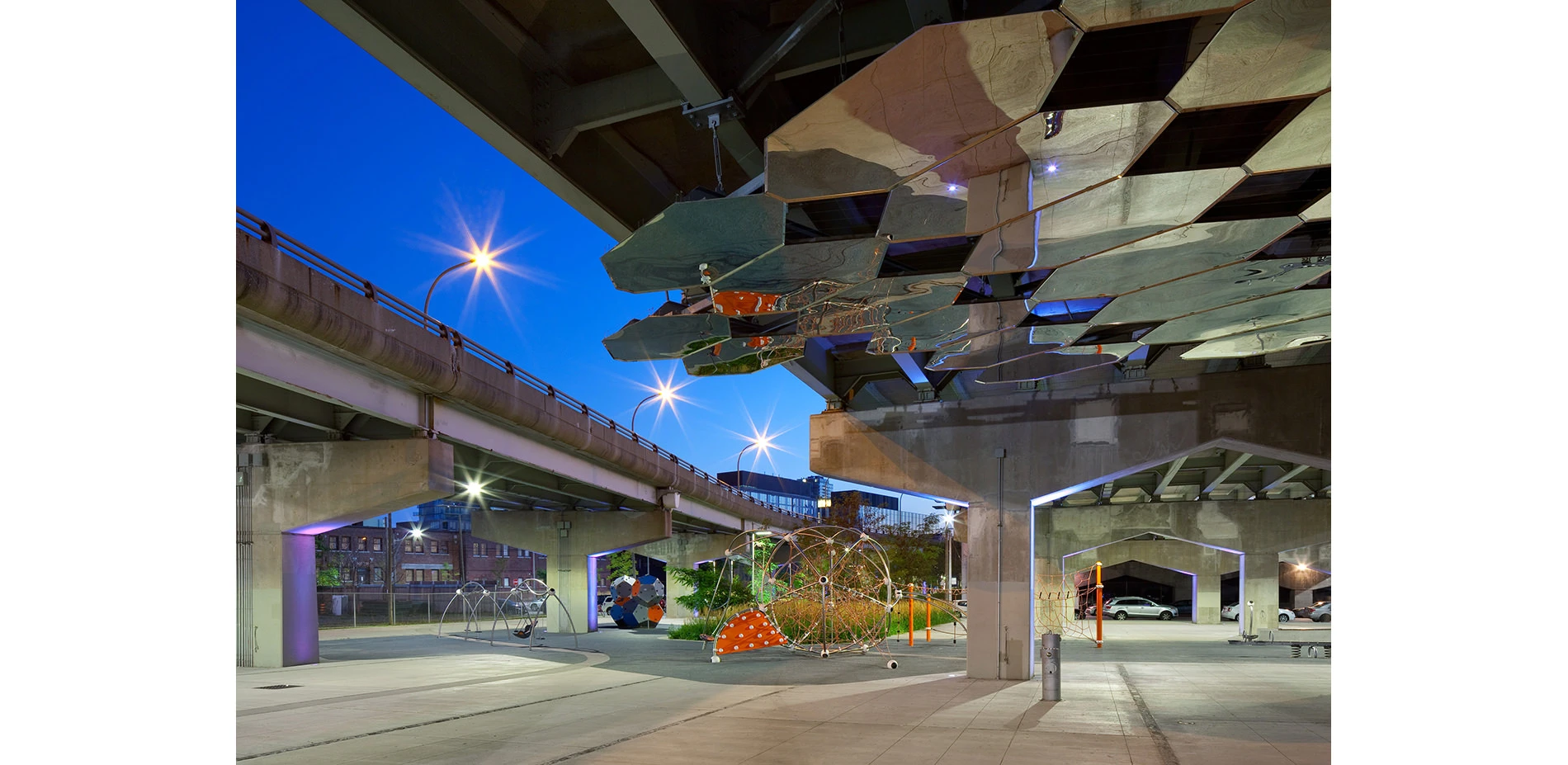
Underpass Park
Underpass Park is a highly imaginative public space in a rather unexpected place. Located beneath a complex of existing highway overpasses in Toronto’s downtown, an otherwise forgotten and derelict remnant has been transformed into an active public park providing diverse recreational and social opportunities while connecting new and existing local neighborhoods and nearby parks. This unique public space is part of Waterfront Toronto’s revitalization efforts of the celebrated new West Don Lands neighborhood. It serves to link Corktown Common, River Square and the neighborhoods of both sides of the overpass complex through the provision of safe and animated public realm design. At a time when urban open-space resources continue to dwindle, and city populations and densities increase, taking advantage of unexpected opportunities, such as the underbelly of an overpass, has proven to be both visionary and essential for the overall health and vibrancy of this area of the city.
General Design
Honor Awards
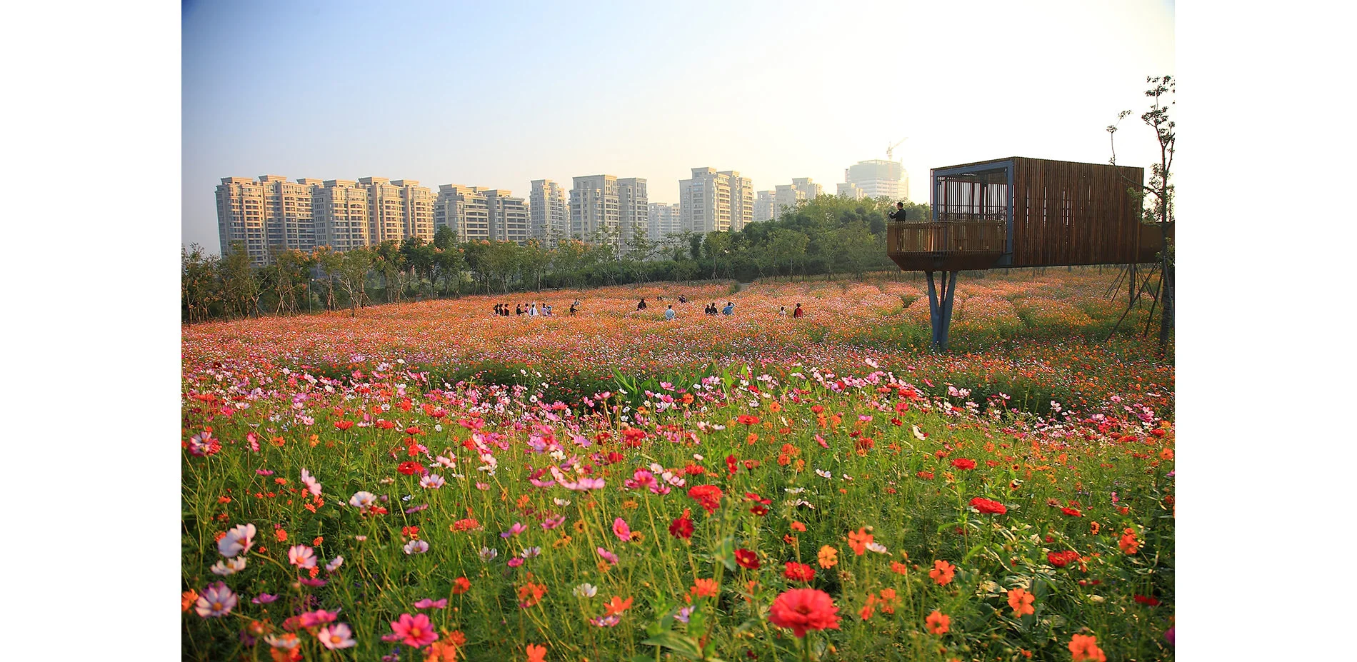
Framing Terrain and Water: Quzhou Luming Park
On a site surrounded by dense new urban development, the landscape architect created a dynamic urban park by incorporating the agricultural strategy of crop rotation and a low maintenance meadow. An elevated floating network of pedestrian paths, platforms and pavilions create a visual frame for this cultivated swathe and the natural features of the terrain and water. Using these strategies, a deserted mismanaged landscape was dramatically transformed into a productive and beautiful setting f
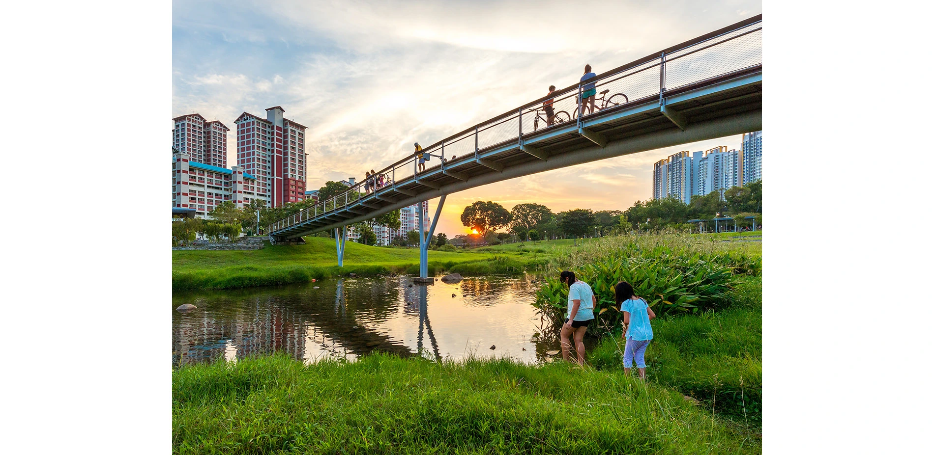
Bishan-Ang Mo Kio Park
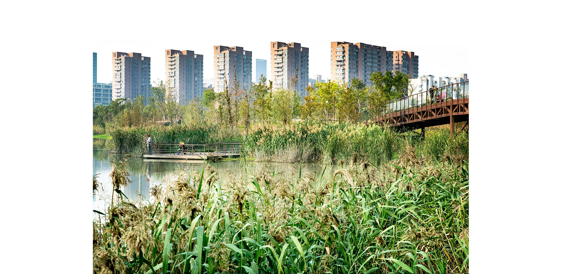
Bishan-Ang Mo Kio Park provides a new model for tropical urban hydrology through the instrument of landscape infrastructure, addressing Singapore’s dual need for water supply independence and flash flood management while creating access to a thriving riverine ecology within the dense city. Prior to redevelopment, Kallang River was a clear dividing line between the park and community as a straight fenced concrete canal in dire need of an upgrade. The design team worked together with the park

Converging Ecologies as a Gateway to Acadiana
St. Landry Parish serves as the northern gateway to Louisiana’s Acadiana region. The proposal for a new visitor center along Interstate 49 was an opportunity to provide visitors their first glimpse of the forests, swamps, and prairies typical of this diverse landscape. Through interpretations of these native landscapes at the new St. Landry Parish Visitor’s Center, travelers are able to gain an understanding of the region’s distinctive character.
The landscape goes beyond simple vis
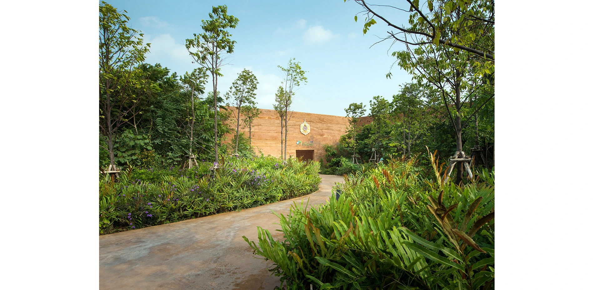
The Metro-Forest Project
Located at the Eastern fringes of Bangkok in the suburban district of Prawet, approximately 6 kilometers from the Suvarnabhumi International Airport, lies The Metro-Forest Project. An ecological regeneration project designed as an outdoor exhibition space to cultivate environmental awareness and educate visitors about local forest ecology. The project, on an abandoned site, aimed to reclaim 2-hectares (4.75 acre) of valuable land and reverse the trends of suburban sprawl, urban heat island,
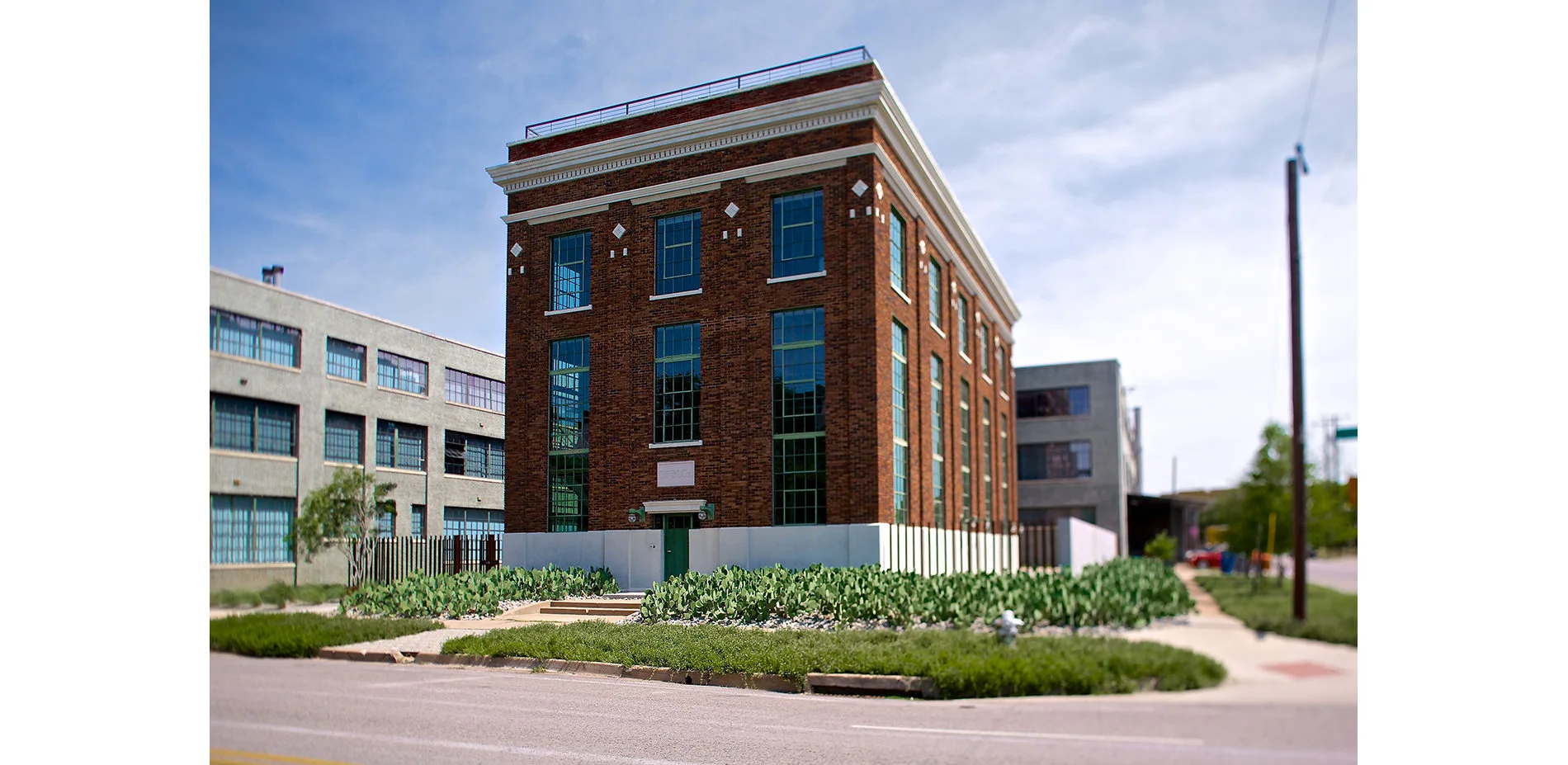
The Power Station
The Power Station is an indoor/outdoor art exhibition space, guest artist’s residence, and not-for-profit organization that invites artists to respond to the raw character of the architecture, a historic, 1926 Dallas Power & Light electrical substation. Here an urban garden gallery has sprung to life within the former industrial compound, healing it back to a semblance of what it may have been before. The building and garden relate to one another gently through the careful manipulation of cr
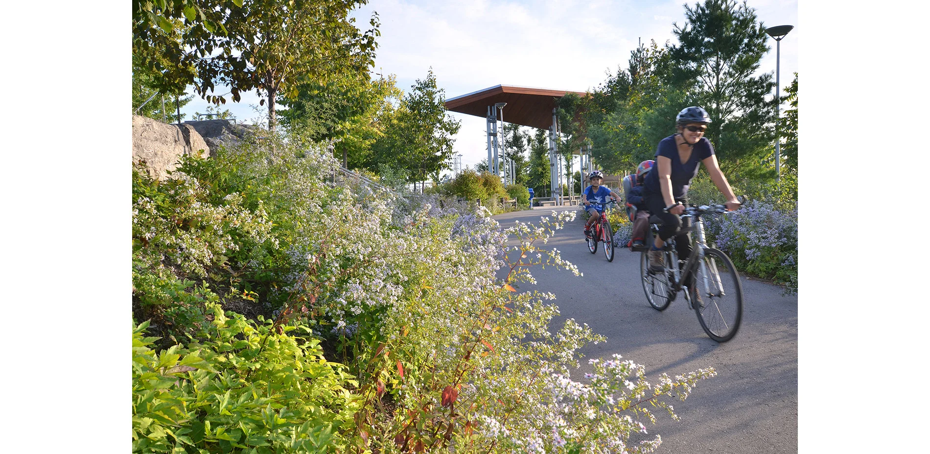
Corktown Common: Flood Protection and a Neighbourhood Park
Corktown Common is an urban park that establishes a model for integrating civic park design into urban flood protection. Below the surface of a biodiverse park replete with Ontario’s native flora is a 4-meter high clay substructure that reshapes the Don River’s floodplain, shielding Toronto’s post-industrial West Don Lands from potential inundation by shunting flood waters south toward the lake.
The riverside prairie portion of the park, with its minimal, passive programming, is des
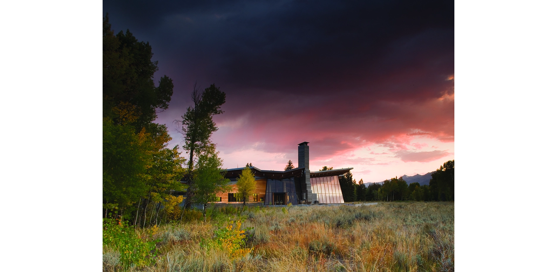
Grand Teton National Park Craig Thomas Discovery and Visitor Center
We will not domesticate this experience! This was our team’s imperative throughout the design of The Craig Thomas Discovery and Visitor Center. Making the profoundly wild accessible, in the sublime and pristine Grand Teton National Park, required a deceptively simple, strong design framework and close team collaboration. With strategically sited paths, a courtyard entrance, and movement through the building, to a broad terrace structure a sequence of visceral immersion in the landscape was c
Eco-Corridor Resurrects Former Brownfield
Through an innovative and carefully composed tapestry of topography, hydrology, and vegetation, the project transforms an uninhabitable brownfield into a linear “living filter.” Ningbo Eco- Corridor creates vital habitat for native flora and fauna, enhances public health, creates beautiful public spaces, and raises the bar globally for sustainable development. Just after the first phase of completion, rarely seen local wildlife has returned – A testament to the health of the restored natural
Residential Design Category
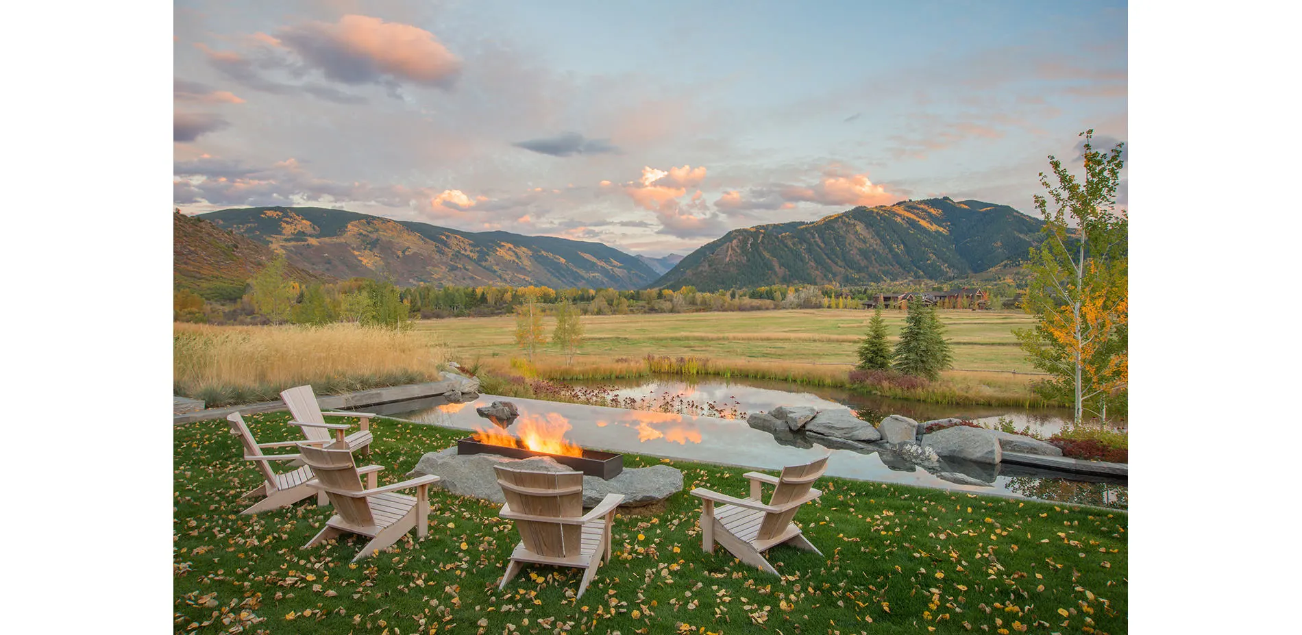
DBX Ranch: A Transformation Brings Forth a New Livable Landscape
Until recently, this 3.5-acre property was the maintenance boneyard for a nearby working ranch. Piles of wood and debris, covered with a layer of fill, had created an artificial landform, resulting in a site that was both ecologically lifeless and unsightly. A collaborative effort combining the creative talents of the landscape architect, architect and interior designer resulted in a new vision for the property, one that reimagines the disturbed site as a livable landscape, emblematic of the
Residential Design
Honor Awards
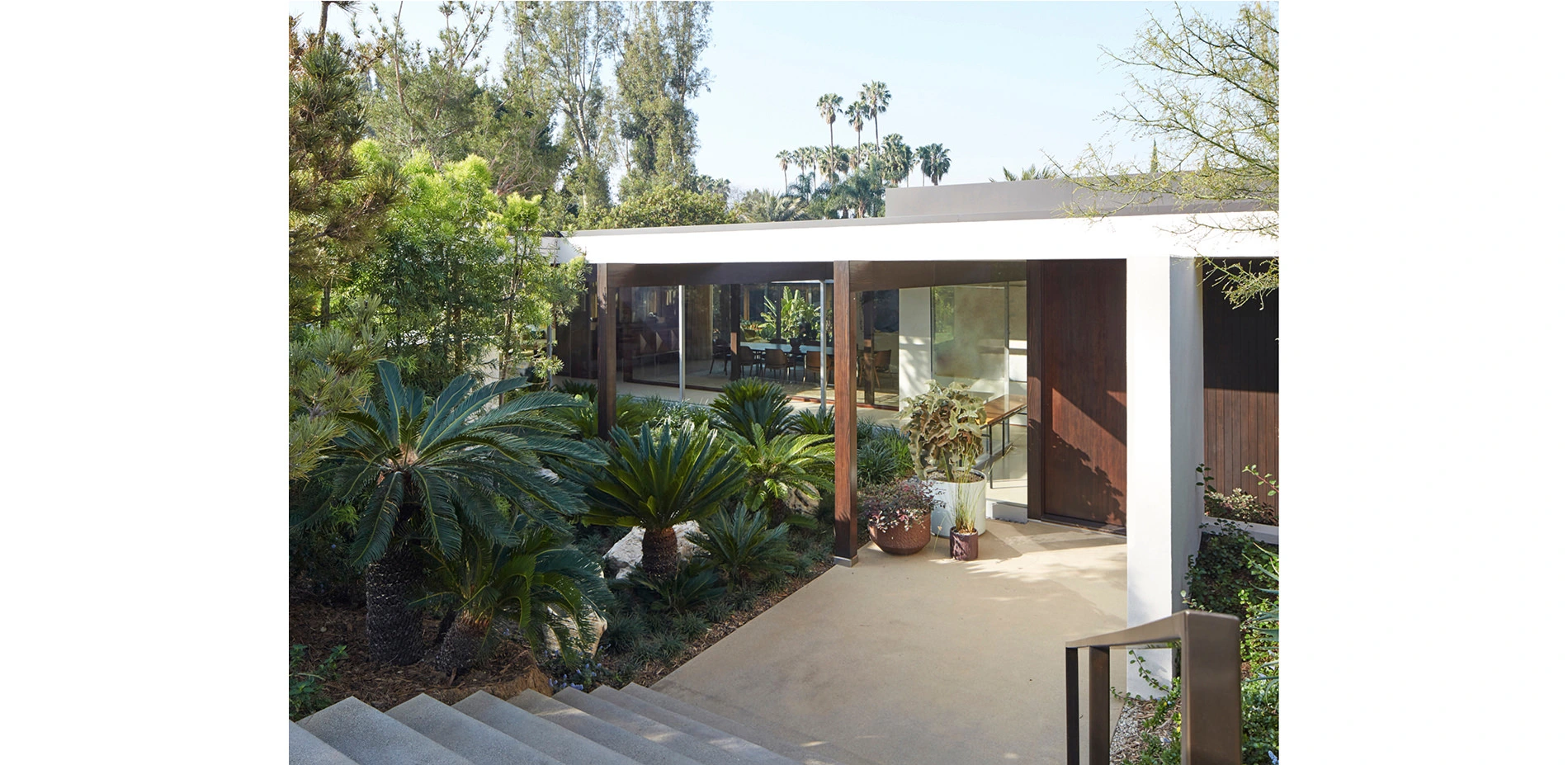
Kronish House
Built in 1954 for a real estate developer and his family, the Kronish House is one of only three Neutra-designed homes ever built in the City of Beverly Hills, and the only one that survives intact. By 2011, the house and landscape had suffered from years of modifications and neglect. Our client purchased the property with the intention of restoring the home and gardens. Throughout the restoration, our team of architects and landscape architects referenced Julius Shulman’s historic photos of
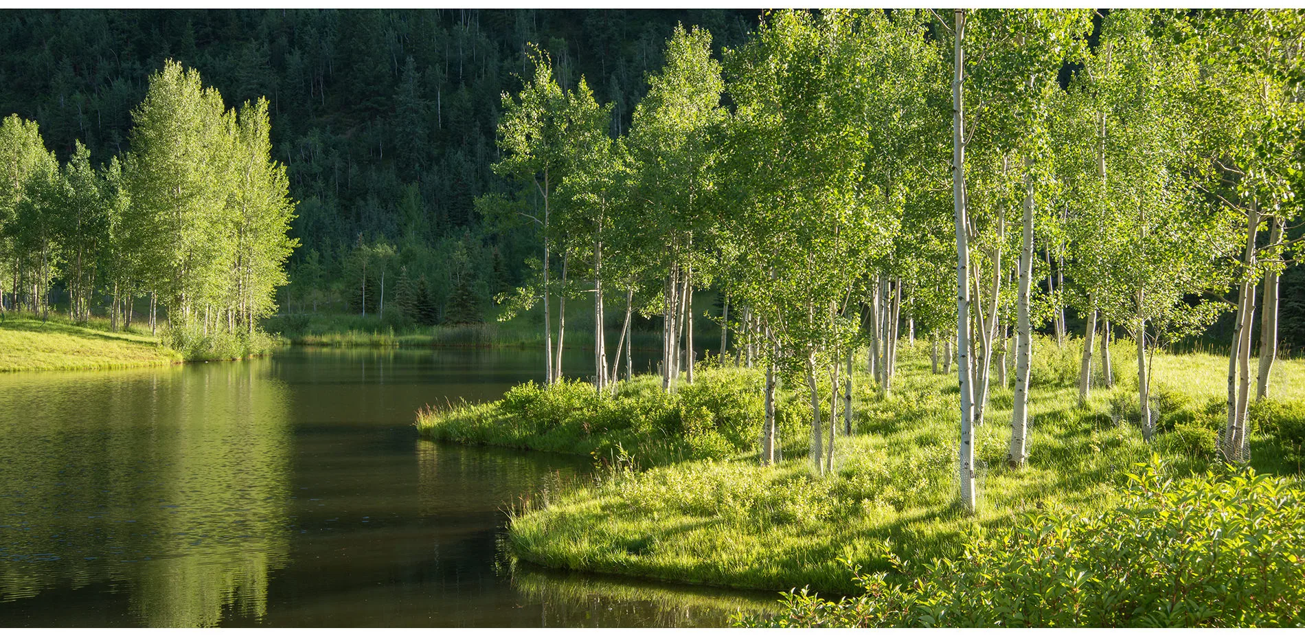
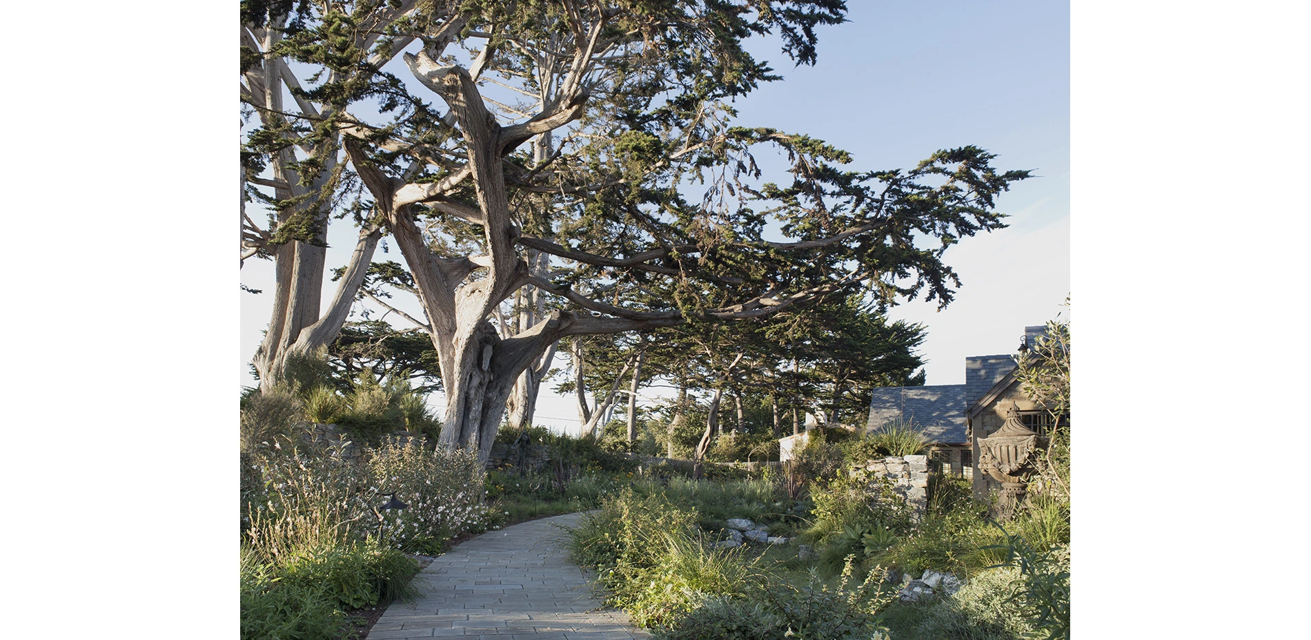
The Restoring of a Montane Landscape
The design for this 28-acre property combines the landscape architect’s creative vision with the owner’s commitment to land stewardship, environmental sustainability and responsible management. The site, a complex and dynamic natural ecosystem, was a virtual wasteland for almost a century, its natural resources – centuries-old Ponderosa pine trees and gravel – harvested and mined for use in building the infrastructure of a burgeoning city. In the 1970s, the abandoned property, identified by its
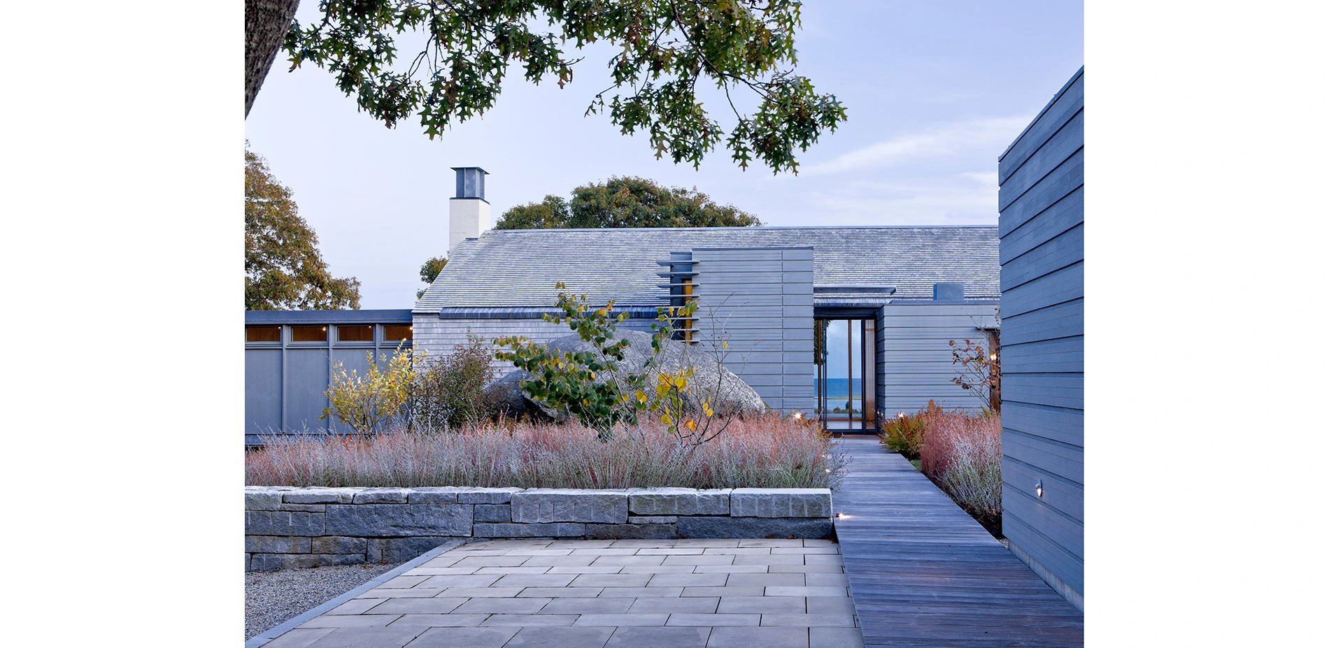
Chilmark: Embracing a Glacial Moraine
Set high on the terminal moraine of Martha’s Vineyard, this project emphasizes the unique quality of a glacial landscape with sweeping ocean views. Existing glacial erratics and mature trees are woven into the design, which employs a minimal number of walls and terraces to ground the house to the site. Close collaboration between the Architect and Landscape Architect fostered a strong continuity of spatial organization and materiality between interior and exterior spaces, effectively blurrin
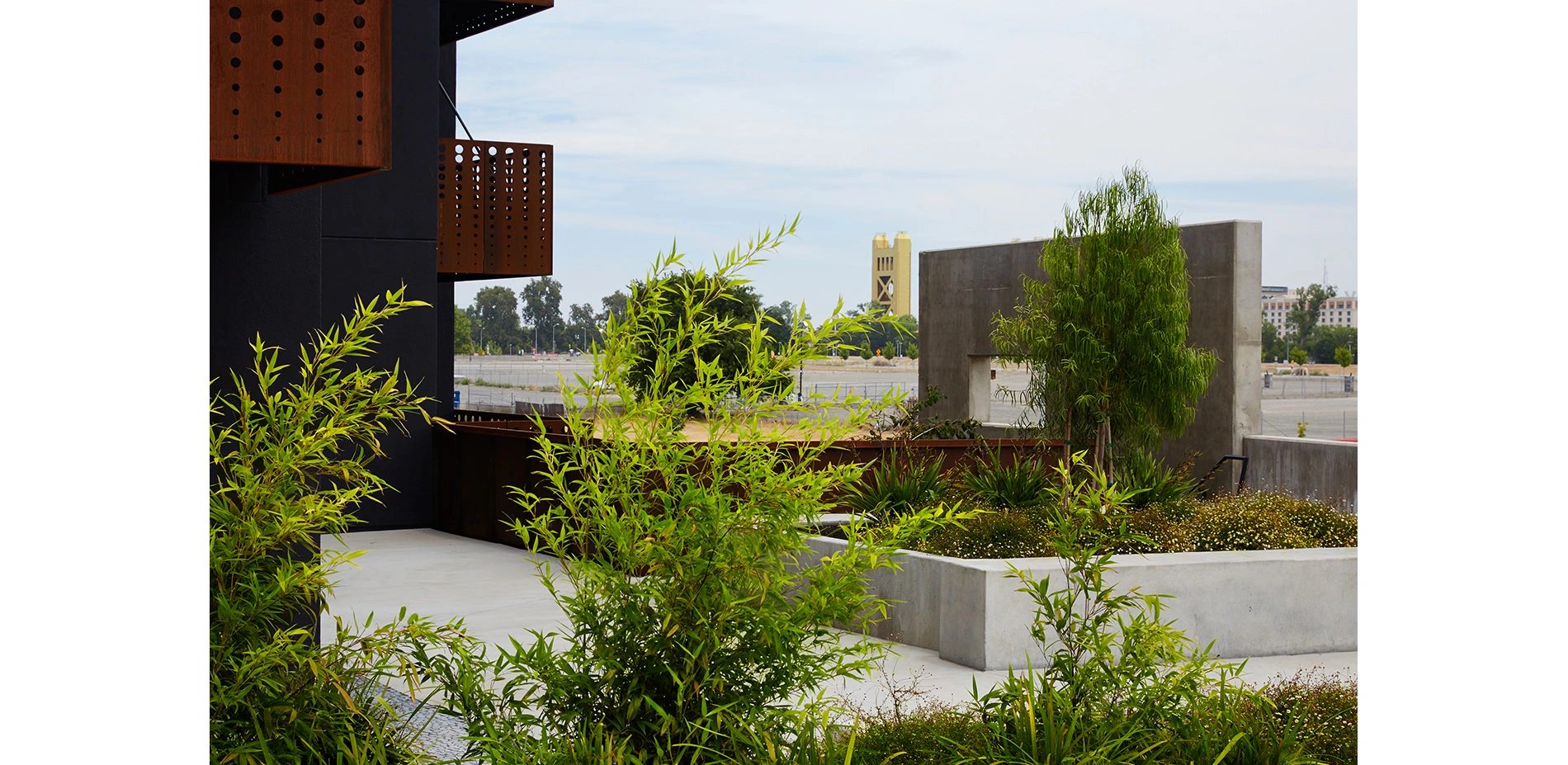
The Rivermark
The Rivermark is located near the Sacramento River. It is a 100% affordable housing project in West Sacramento. The Landscape Architecture responds to the context of the Sierra foothill geology, and also the structures and spaces of early video game design. The design is also inspired by pioneering video games, such as Tempest, a pioneering video game that featured an exciting perspectival geometry. The project is divided into a rigorous two-foot grid, oriented on the east-west axis. Forms a
Water Calculation and Poetic Interpretation
The client’s objective was to create a narrative experience based on J.R.R. Tolkien’s Middle Earth on three quarters of an acre. Our objective was to create a sustainable garden habitat with a story running through it.
We found opportunity for art and storytelling in all aspects of the project. Our goal was to design every built element as both a working feature and a highly crafted work of art. A team of artisans, craftspeople and consultants took our design ideas to the next level
Analysis and Planning Category
The Copenhagen Cloudburst Formula: A Strategic Process for Planning and Designing Blue-Green Interventions
Following a 2011 Cloudburst that caused damage of approximately USD $1 billion, climate change mitigation solutions became an urgent focus for the city of Copenhagen. The flood’s consequences transcended jurisdictional boundaries, necessitating a truly collaborative effort be established between planners, engineers, economists, citizens, utility providers, politicians, and investors to integrate Climate Adaptation within regulatory planning.
The result is the Copenhagen Cloudburst Formula, a flexible, universally adaptable model for mitigating increasingly common extreme flood events – or Cloudbursts – through Blue-Green solutions that integrate urban planning, traffic, and hydraulic analysis with sound investment strategies to improve the quality of cities’ Liveability.
Existing city space is valuable. A cost-benefit analysis, conducted on the 10km2 catchment, concluded that the potential of implementing a surface-first approach to mitigating Cloudbursts over solely pipe-based systems reduced investment costs by over $200 million.
The trickle-down effect has been the identification of over 300 citywide pilot projects, the incorporation of flood management design guidelines within local developer requirements, and the testing of the Copenhagen Cloudburst Formula applicability throughout Europe, the Americas, and Asia.
Analysis and Planning
Honor Awards
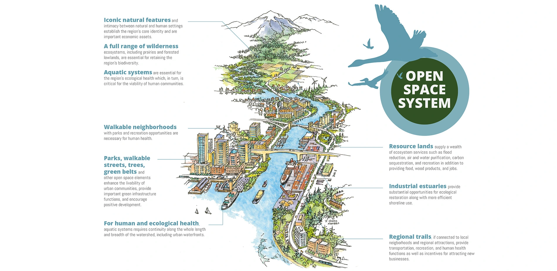
Central Puget Sound Regional Open Space Strategy
Seven people per hour make the Puget Sound region their new home, with this population explosion impacting biodiversity, social equity, and human health. Compounded by the challenges of climate change and uneven economic development, it has become urgent to coordinate efforts across the hundreds of jurisdictions and non-profit organizations to protect, enhance and connect a regional open space network accessible to all. The Regional Open Space Strategy (ROSS) is a multi-scale planning effort
Rebuild by Design, The Big U
The Big U is a modular, replicable system for adapting coastal cities to climate change. In response to Superstorm Sandy, the landscape architect envisioned protective landscapes that could enliven, rather than cut off, the City’s waterfront. For HUD's Rebuild by Design competition, the firm teamed with internationally-renowned collaborators to expand that idea into a ribbon of protective infrastructure that wraps around Lower Manhattan. With the public outreach framework developed by the la
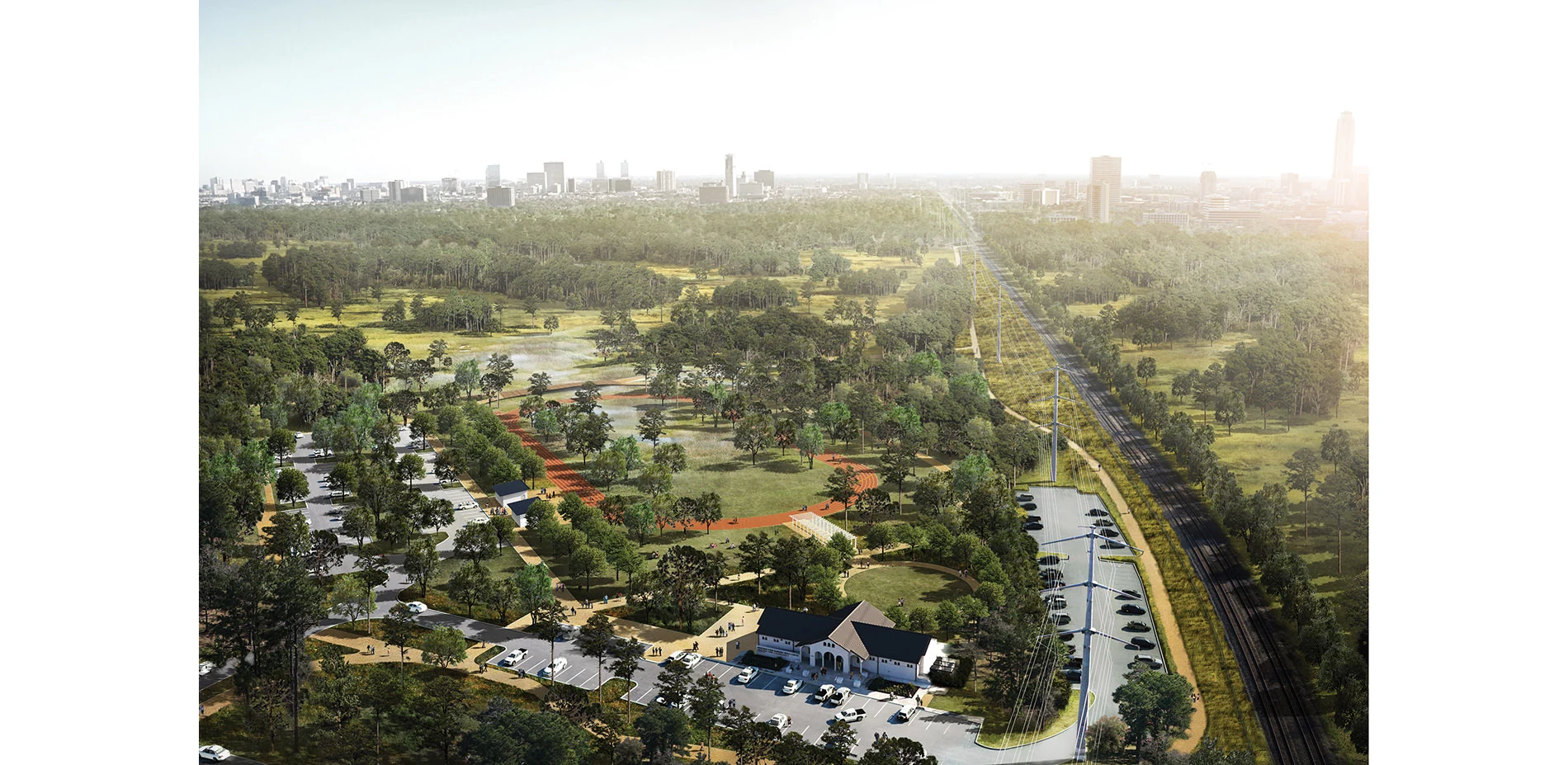
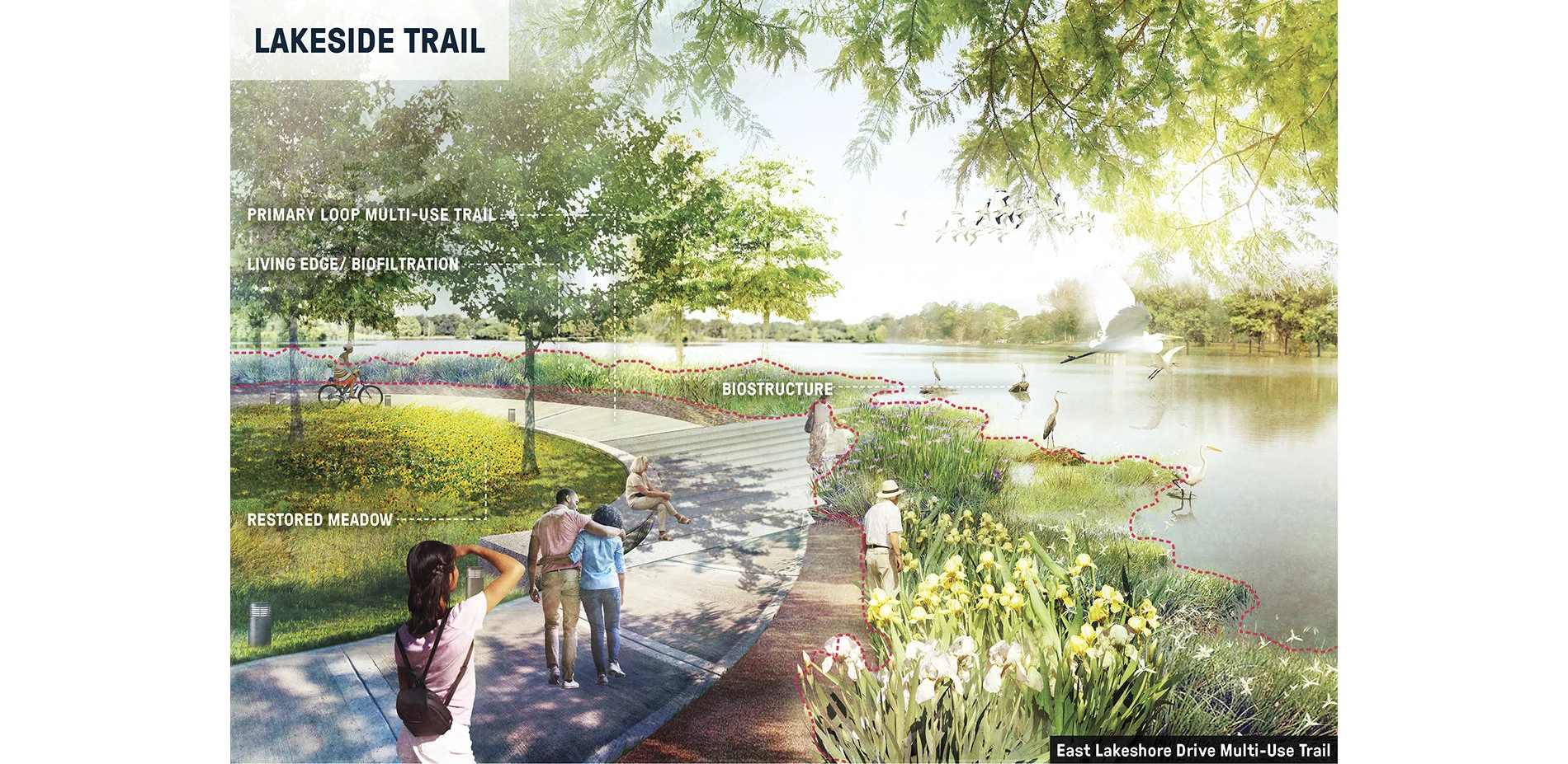
Memorial Park Master Plan 2015
Memorial Park in the 21st Century – A Master Plan
Houston’s Memorial Park has been fragmented by roads and by the placement of recreational program in sensitive wilderness areas, leading to ecological degradation and diminished quality of spaces. Recent hurricanes and years of extreme drought have devastated the park manifesting widespread canopy loss. This major and sudden change in the character of this beloved 1,460-acre park has led to public outcry and demand for a call to acti
Baton Rouge Lakes: Restoring a Louisiana Landmark from Ecological Collapse to Cultural Sanctuary
Baton Rouge and Louisiana are uniquely tied to the relationship between man and water. Water’s ability to impact people and people’s ability to influence water are inseparable. Currently this relationship is being tested as one of Baton Rouge’s iconic water systems struggles with its identity.
The Baton Rouge Lakes project recognizes opportunity in crisis. The 275 acre lakes system is a series of six lakes in central Baton Rouge. Adjacent to Louisiana State University, three major p
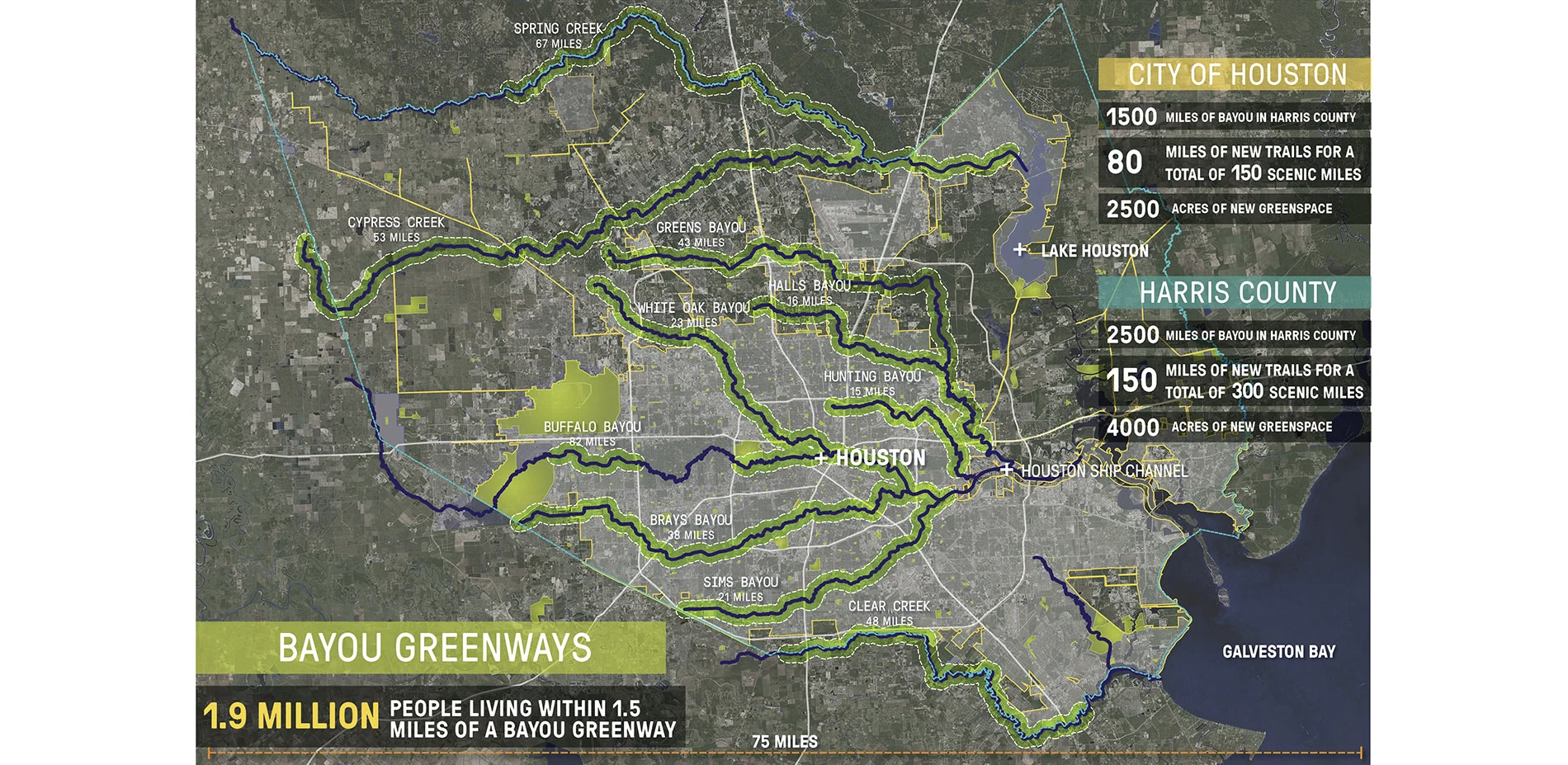
Bayou Greenways: Realizing the Vision
Bayou City? At first glance, the Houston region’s sprawling development footprint, hyper engineered transportation systems, and massive industrial complexes seem to render this historic city nickname more delusion than reality.
Based on Arthur Comey's 1913 report, "Houston, Tentative Plans for Development", the recently completed Bayou Greenways Master Plan creates a new 300 mile long linear park system connecting over 1.9 million citizens along Harris County’s 10 major waterways. W
Research Category
Honor Awards
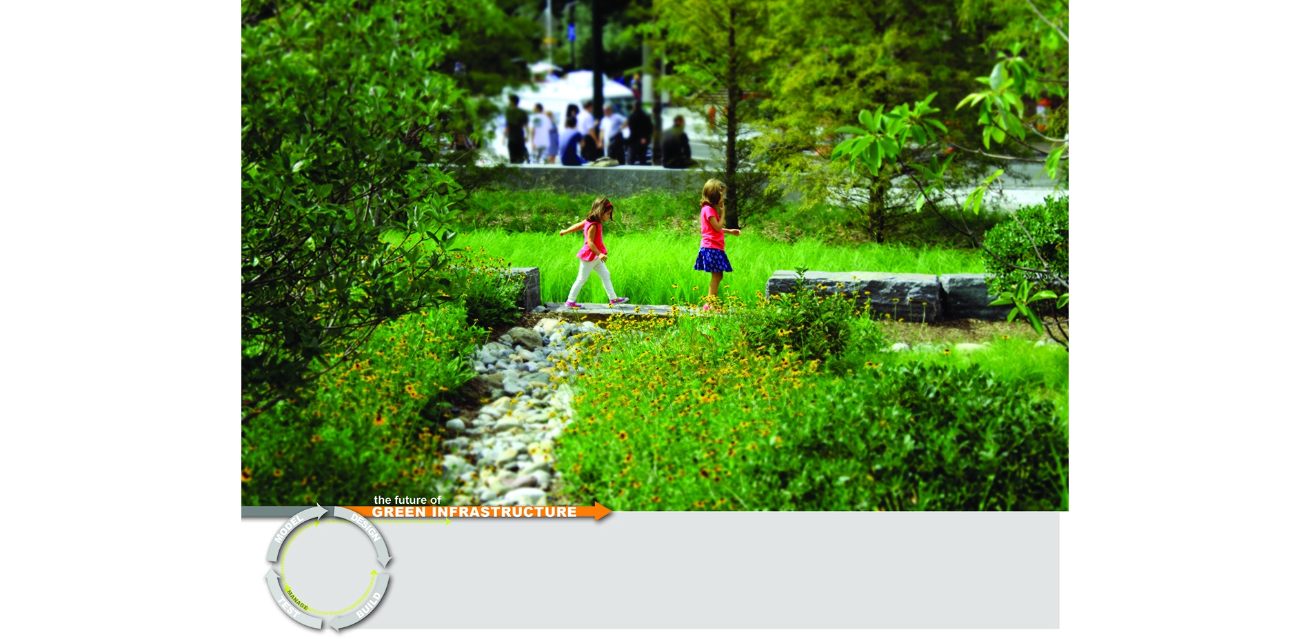
Weather-Smithing: Assessing the role of vegetation, soil, and adaptive management in urban green infrastructure performance
Landscape architects face increasing pressure to design high-performance landscapes in cities where regulatory requirements and underlying engineering models tend not to reflect the measurable capacity of green infrastructure within different contexts, particularly soil storage and evapotranspiration. Understanding how built green infrastructure performs is critical in informing new engineering models, advocating progressive regulations, and advancing sustainable landscape design. To help ad
Communications Category
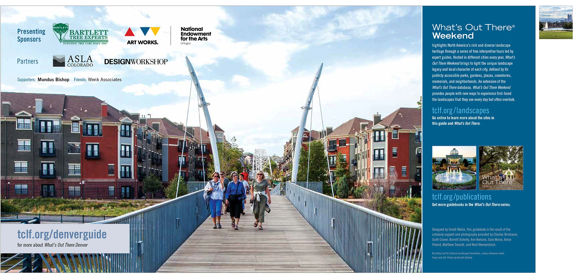
What’s Out There® Guidebooks
The Cultural Landscape Foundation’s (TCLF) What’s Out There guidebooks are concise, richly illustrated publications that provide overviews about the design history of mostly urban areas throughout the U.S., locates significant works of landscape architecture of each city on a map, and include 250-word essays and full-color photographs of each site. The guidebooks—usually more than 60-pages in length—are attractively designed and professionally printed as 8x8-inch, easily portable paperback books. The guidebooks are also available as free digital downloads. They derive from the What’s Out There database of nationally significant landscapes and their designers, and are created in tandem with the What’s Out There Weekend series of free, expert-led tours. Developed in collaboration with local partners, the guidebooks are intended for a diverse audience, including landscape architecture professionals and students, educators, tourists, and design enthusiasts. To date, thirteen guidebooks have been produced.
Communications
Honor Awards

Roving Rangers: Bringing the Parks to the People
Parks don’t move. This is obvious, but when your goal is to bring the majesty of the Golden Gate or the Santa Monica Mountains to more people, the static nature of trails, trees and ocean views can pose a challenge. This is especially true today, because even as America’s diversity is increasing, our state, regional and national parks struggle to attract minorities [1].
Enter the Roving Rangers. These two bright and beautiful mobile park ranger stations made from retrofitted bread t
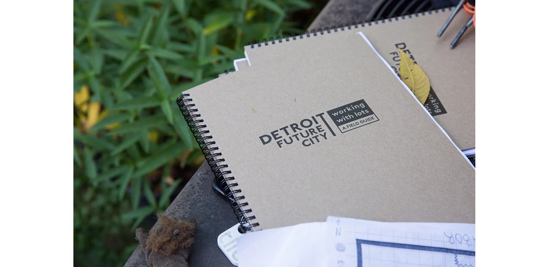
Activating Land Stewardship and Participation in Detroit: A Field Guide to Working With Lots
The Field Guide to Working With Lots is a hands-on tool for vacant land transformation in Detroit. Primarily a website, the Field Guide (www.DFC-lots.com) was created to expand the local understanding of what is possible on vacant residential and commercial land, while providing broadly accessible and actionable site strategies. The website includes 34 designs for scattered site vacant lots, profiles of local land stewards, and practical tools such as a directory of landscape suppliers. The
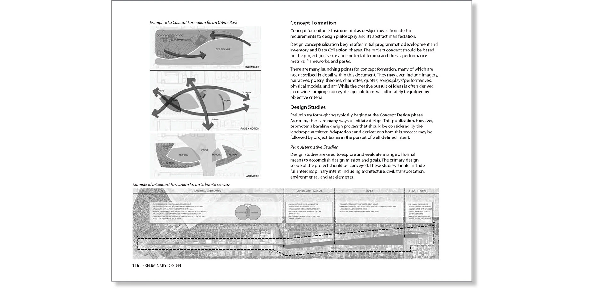
Landscape Architecture Documentation Standards: Principles, Guidelines and Best Practices
Landscape architecture is well positioned to address the most fundamental challenges faced by communities, cities and nations. In order to respond to these challenges, theory and practice must be well integrated, suggesting a critical need for effective translational relationships between theory and implementation. This publication explicitly strengthens the relationships between design, documentation and built outcomes, and bridges the training gap between academia and the profession.
<
PHYTO: Principles and Resources for Site Remediation and Landscape Design
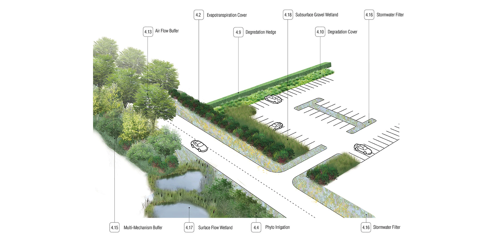
‘PHYTO’ presents the concepts and application of phytoremediation and phytotechnology in one comprehensive guide, illustrating when plants can be considered for the uptake, removal or mitigation of on-site pollutants on a range of landscapes such as brownfields, landfills and military sites. Current scientific case studies are covered, highlighting the advantages and limitations of plant-based cleanup. Typical contaminant groups found in the built environment are explained, and plant lists f

Sea Change: Boston
Sea Change: Boston is a research initiative on sea level rise that advocates for long-term coastal resiliency in the Greater Boston area. The Sea Change team, led by landscape architects, collaborated with experts in science, academia, advocacy, and policy-making to engage in preparedness planning at the building, city, and regional scales. Designers curated an exhibition to showcase this research, highlighting Boston's vulnerabilities and demonstrating design strategies for resilience. The
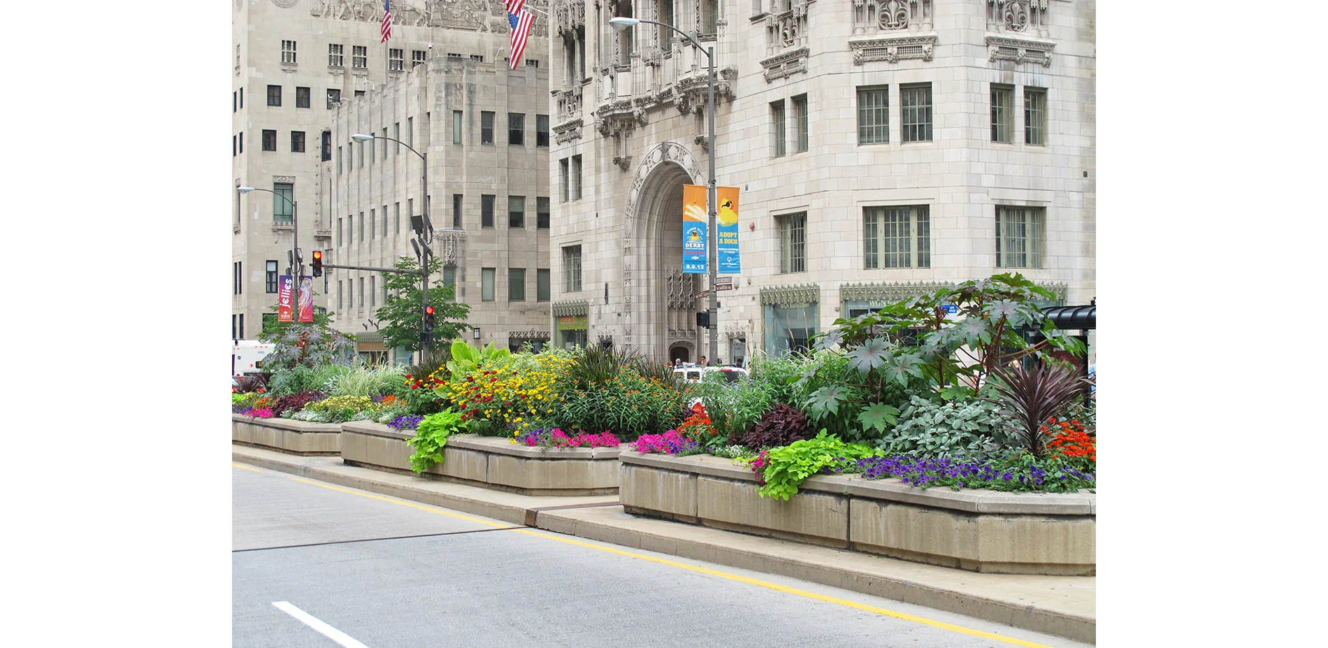
Michigan Avenue Streetscape: 20 Years of Magnificent Mile Blooms
Since 1993, a bold strip of beautiful landscape has run down the median of Chicago’s Magnificent Mile. It spans the 33 blocks (2.3 miles) from Roosevelt Road in Chicago’s Loop up to Oak Street in the city’s Gold Coast, enlivening the prominent street with seasonal plant displays of enormous scale, color, complexity, and texture. The project originated in 1991 as an initiative introduced by Mayor Richard M. Daley and a committee of prominent Chicago business and civic leaders to beautify one of the city’s most prime pieces of real estate and transform it into a stunning public space.
Three different displays are carefully planned and installed annually so as to remain seasonally appropriate. The original design team produced more than 60 different schemes over the project’s first 20 years; today, a new landscape firm carries on the work. Due to the project’s success, Chicago has since landscaped more than 100 miles of median space. Many other cities have followed suit, making the Magnificent Mile median an international model for civic urban landscape design.